
Blog
Site Feed
About Me
Biography
Resumé
Writing
Radio Shows
Travel Narratives
Internet Oracle
Collections
TV Guide
Jingles
Contact Me
Blog Archives
Monday, August 07, 2006
The freeways of 50 years ago
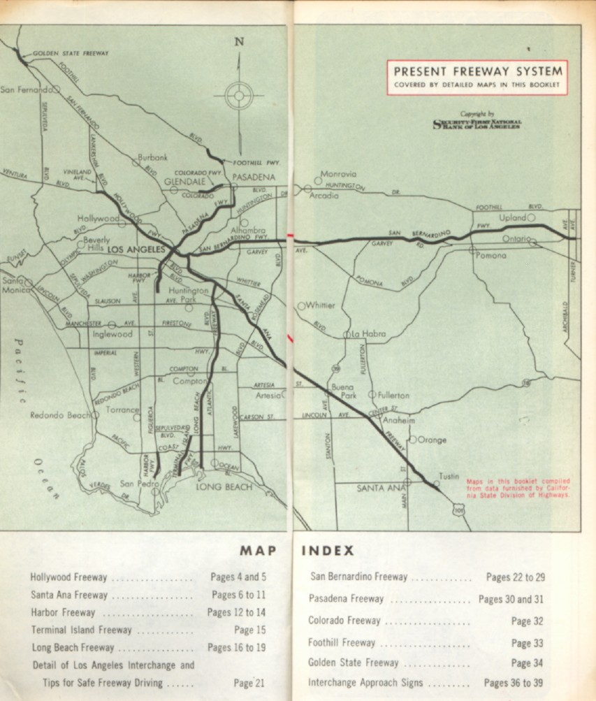
Levi sent me a link to this beautifully illustrated 1942 map of Los Angeles in the Library of Congress's collection, which reminded me that I have in my collection a 1956 booklet published by the Security-First National Bank of Los Angeles titled "Freeway Map of Los Angeles." It's specifically dated August 1956, so it's now exactly 50 years old.
The extent of the freeway system...

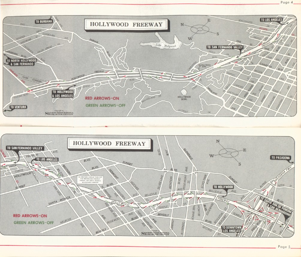
Detail of the Hollywood Freeway, from its terminus at Vineland and Ventura (lower left of upper map) to downtown (lower right)...

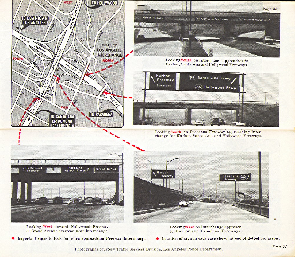
And the best thing in the booklet: a detail of what it calls the "Los Angeles interchange," complete with photographs of the signs (people know this today as the intersection of the 101 and the 110 freeways, and the current signs -- which are at least 20 years old -- are fairly similar)...

The extent of the freeway system...

Detail of the Hollywood Freeway, from its terminus at Vineland and Ventura (lower left of upper map) to downtown (lower right)...

And the best thing in the booklet: a detail of what it calls the "Los Angeles interchange," complete with photographs of the signs (people know this today as the intersection of the 101 and the 110 freeways, and the current signs -- which are at least 20 years old -- are fairly similar)...

Comments:
Not really "originally," since the U.S. 66 number predates the freeways. But it eventually got routed off "surface streets" such as Figueroa onto the Pasadena Freeway south to the Hollywood Freeway north (and then on Santa Monica Blvd. west to the ocean).
That's the main reason U.S. 66 doesn't officially exist anymore -- so much of it ended up routed along freeways that already had their own numbers (from Interstate 55 in Illinois all the way to U.S. 101 in California) that the U.S. 66 number was deemed superfluous.
Post a Comment
That's the main reason U.S. 66 doesn't officially exist anymore -- so much of it ended up routed along freeways that already had their own numbers (from Interstate 55 in Illinois all the way to U.S. 101 in California) that the U.S. 66 number was deemed superfluous.